Rol Naath
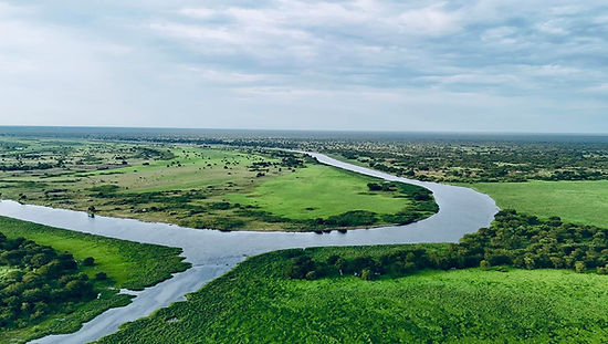
Rol Naath is a de facto autonomous region that maintained political, economic, and social independence until 1943, after which it formally integrated into the Sudanese political system in 1947. Currently, it is pursuing unilateral separation and the dissolution of its 1943 political union with South Sudan. Geographically, Rol Naath is predominantly located within South Sudan, with portions extending into Ethiopia. The region is distinguished by its vast marshlands, savannahs, thorn forests, and the Sudd wetland, which is the largest swampy area in Africa and the second largest in the world. It shares borders with the Dinka of Bahr El-Ghazal to the west, Sudan and the Shilluk Kingdom to the north, the Burun to the northeast, Ethiopia to the east, the Anyuak and Murle to the southeast, and the Dinka Bor to the south.
The Nuer people have a long-standing history of resistance against colonial powers. They successfully repelled incursions by the Ottoman Empire's Muhammad Ali, who was then the governor of Egypt, as well as aggression from Northern Sudanese Arab slave traders and the British administration in Sudan. Towards the end of the 20th century, the emergence of the Nuer White Army, driven by the spirit of protecting their people and territory, became recognized as one of the most formidable community defense forces in Africa. During the 18th and 19th centuries, when global superpowers were engaged in conquest and expansion, the Nuer also pursued their own territorial expansion, increasing their land from 8,700 square miles to 35,000 square miles between 1820 and 1880. This marked one of the most significant territorial expansions by an ethnic group in ethnographic history. The Nuer maintained complex relationships with neighboring ethnic groups, particularly the Dinka, Anyuak, and Murle.

The Ottoman Turks, who had invaded Sudan in 1821, recognized the Nuer as a sovereign entity following their encounter during the 1885 Battle of Mut Roal, where the Nuer achieved a decisive victory. Shortly after acknowledging their defeat, the Turks signed a treaty, thereby ceasing the hostilities of Muhammad Ali's army in Nuerland until their withdrawal from Sudan the following year. In 1898, the British Anglo-Egyptian forces invaded Sudan, bringing an end to the Mahdist regime. However, it was not until 1916 that the British administration dispatched its first patrol to Nuerland. During this period, British officials met with Nuer spiritual leaders, including Prophet Guek Ngundeng in Wec Deng village and Prophet Dual Diu, in what was then referred to as the "Nuer Settlement," now known as Ayod in Gawar land. The British administration formally acknowledged that the Nuer territory constituted an independent state, characterized by its own legal systems, cultural practices, traditions, and a distinct sense of sovereign pride that distinguished it from other African nations. This acknowledgment prompted the British administration to negotiate a de jure political agreement, which was signed in 1943 and formally ratified in 1947. Under this pact, the Nuer agreed to relinquish their political independence in exchange for integration into the political union of Sudan.
Before 1943, the Nuer political system was notably robust. The Fangak region served as a parliamentary hub, where the Nuer formulated the laws that governed Nuerland, many of which remain in force today. The Nuer people undertake pilgrimages to the sacred site in Wech Deng village, home to the Ngundeng Pyramid. This pyramid became a powerful symbol of Nuer resistance against British colonial rule. In 1928, the British Royal Air Force bombed the pyramid to undermine Nuer resilience, leading to its partial destruction and the assassination of Nuer prophet Guek Ngundeng in 1929. Despite this, the Nuer's resistance to colonial domination continued until the signing of a formal agreement.
After the British withdrawal from Sudan in 1956, Northern Sudanese Arabs systematically oppressed and marginalized the Southern Sudanese population, including the Nuer. This prompted the Nuer and other Southern Sudanese groups to struggle for self-determination, which they achieved in 2011. However, in subsequent years, the Nuer's sacrifices were largely forgotten. Between 2013 and beyond, the Nuer faced exploitation, disenfranchisement from their resources by the South Sudanese government, and repeated attacks by armed groups along Nuerland's borders. These events prompted the Nuer to reflect on and recognize the errors of their 1943 decisions. Consequently, the Nuer people and their leadership now seek to nullify the 1943 de jure agreement with South Sudan and restore the pre-1943 Nuerland political structure.
The leadership of Rol Naath maintained that the integration of the Nuer people with other nations in Sudan, and subsequently within Southern Sudan, ultimately led to a catastrophic union. This union exacted a heavy toll on the Nuer, resulting in the loss of lives, cultural heritage, traditions, customs, resources, and their way of life. They asserted that reclaiming Nuerland's sovereignty is the sole path to resolving the myriad challenges faced by the Nuer people.
Our History
During the early nineteenth century, the Nuer people undertook significant migrations and territorial expansions, characterized by a series of conquests. These expansions were largely driven by repeated raids and the displacement of the Dinka and Anyuak peoples from their lands. This period is recognized as one of the most notable instances of ethnic imperialism documented in ethnographic studies.
At the beginning of the 1800s, the Nuer occupied an area of approximately 8,700 square miles in the Western Nile region, encompassing the territories of the Bul, Leek, Western Jikany, Jagei, and Dok tribes, situated west of the Nile River and north of the 7°52 N latitude. This region was entirely encircled by Dinka territories. By 1890, the Nuer had extended their influence into the Eastern Nile basin, penetrating deep into Dinka lands and encroaching upon a substantial portion of the Anyuak territory near the Ethiopian escarpment.
By the early nineteenth century, the Nuer had expanded their territorial holdings to approximately 40,000 square miles. This significant enlargement occurred over a relatively short span of about eighty years, from 1800 to 1880. However, external factors, such as the territorial conquests by Abyssinia and the Ottoman Empire's incursions into North Sudan in 1821 and 1827, ultimately curtailed further Nuer expansion.
The territorial expansion of the Nuer in the 19th century was primarily driven by two key movements led by two individuals: Latjor, who commanded the Jikany, and Bidiet, who led the Lou. Neither of these men held formal political status or ritual authority; however, they were celebrated as exceptional warriors, distinguished by their remarkable leadership, martial skill, and ability to galvanize the youth for raiding expeditions. The first major movement involved the migration of the Jikany far to the east, toward the Sobat River and extending as far as the Ethiopian border, hundreds of miles from the Nuer homeland. Initially, the Jikany moved northward to Jebel El Liri, near the border of Nuba territory, before turning eastward along the boundary between the Nuba and Shilluk regions. In this area, they engaged in battle and defeated Reth Awin, the Shilluk king. Subsequently, they traversed Shilluk territory near Melut, crossed the Nile during the dry season, and entered northern Dinka lands. After clashing with the Dinka and seizing a significant number of cattle, they turned southward and advanced to the lower Sobat River. They temporarily settled around Abwong before moving upstream along both banks of the Sobat to their current territory.
The second wave of Nuer expansion was led by the Lou Nuer and Gawaar, who advanced through the central heartland of Dinka territory. The Lou Nuer extended their reach as far east as the border of the eastern Jikany enclave. This movement, which began shortly after the initiation of the Jikany migration, was referred to as the "twin migration" in the context of the Nuer's efforts to expand their territorial control. The Gawaar, originally inhabiting the southern part of Dok territory, migrated to their current homeland by crossing the Nile and settling in one of the world's largest swampy regions, the Sudd. Meanwhile, the Lou Nuer, who previously shared territory with the Jagei, crossed the Nile approximately fifty miles to the north during the same period and established themselves in the present-day territories of the Lak and Thiang Nuer.
Following the Twin Migration, another significant Nuer territorial expansion occurred with the migration of the Lak and Thiang Nuer. They crossed the Nile and moved north of Zeraf Island shortly after the Lou Nuer had advanced further east to the border of the eastern Jikany and southward. Zeraf Island, initially conquered by the Lou Nuer, became a focal point of these movements. It is important to note that these two migratory movements—the Lou Nuer's eastward expansion and the Lak and Thiang Nuer's northward migration—were carried out independently of one another.
During the period from 1845 to 1876, while the Eastern Jikany, Lou, Gawaar, Lak, and Thiang were extending Nuer territory east of the Nile, the Nyoung Nuer migrated southward along the western side of the Nile, displacing and driving the Shish Dinka further south. This movement signified the conclusion of the Western Nuer (homeland) territorial expansion on the western side of the Nile. However, on the eastern side of the Nile, Nuer territorial expansion persisted until the early 2000s. Another minor expansion effort by the Western Nuer toward the west and north saw limited success. The lack of success in these westward and northward expansions was unsurprising, as significant portions of the Nuer homeland had already been vacated by the Eastern Jikany, Lou, Gawaar, Lak, and Thiang.
These territorial expansions resulted in the division of the Nuer into three distinct tribal groups:
1. The Western Nuer (Homeland Nuer):
- Bul
- Leek
- Western Jikany
- Jagei
- Dok
- Nyoung
- Haak
2. The Central Nuer:
- Fangak Nuer:
- Lak
- Thiang
- Gawaar
- Lou Nuer:
- Baal
- Moor
- Dak
3. The Eastern Nuer (Eastern Jikany Nuer):
- Gajiok
- Gajaak
- Gaguang
Rol Naath
Government
